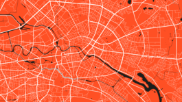
Welcome to the RAUMSONDE BERLIN!
RAUMSONDE is a support tool for planning events and preparing permit applications for events in open and free spaces in Berlin's dynamic urban landscape!
On 31.03.2025, the new version of the RAUMSONDE tool will finally go online.
You can then use the tool to quickly and easily have your events in public spaces checked for their basic eligibility for approval.
In addition to comprehensive information on the necessary steps, you can use the application assist to create your special use permit application.
If you do not yet have a location, you can use the mapping tool to gain an initial insight into where possible locations for an event are.
The Kollektiv Spieltrieb team wishes you lots of fun with the Raumsonde tool!
The RAUMSONDE provides 5 tools:
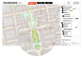
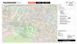
The SPACE MAP can help you find a suitable location for your event. Select the parameters important for determining a good location, and the tool will show suitable spaces on the map. For example, you can see different district boundaries, public transport connections, the distance to the closest residential area (in case you want to make some noise), the location of public toilets or waste bins, as well as protected areas and different categories of space. These can be displayed over a classic map or a satellite image.
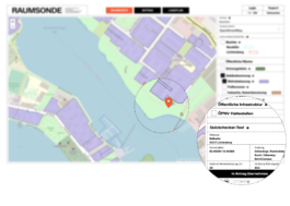
The QUICK CHECKER TOOL gives you a concise summary of important informations on a selected location, such as address, coordinates, usage, and distance to the nearest residential or protected area in metres, so you can quickly assess whether the location is interesting for you or not.
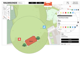
The SITE PLAN assists you in creating an overview of the location and the event setup. It is useful to demonstrate what you want to do and where it will be set up in greater detail when applying for a permit. With the tool, you are also able to draw a plan of the layout of your event to scale as an overlay on the map. Such a plan can increase your chances of obtaining official approval for your event because the authorities will have a clear idea of what to expect.
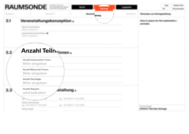
Application Assistant
The APPLICATION ASSISTANT (Starting early 2024) is designed to help with applying for necessary permissions for your event. Following the step-by-step process, from your inputs, the assistant can generate many of the forms and documents you will need to send to the relevant authorities, and help you get them to the right place.
Depending on the location (street, park, square, private space etc.), different permissions may be required. Also the type of event, number of guests and other factors such as drink or food, etc. will determine permissions may be required. Temporary events in public spaces often also need a special use permit. If you put all your details of the planned event in the assistant, it will help you figure all this out step by step.
If you lost track or want to find out about the legal background, you can visit our INFOCENTER, where you will find information about all this to help you find your way.
In the INFOCENTER you will find a lot of helpful background information and a wide range of knowledge about all kinds of basic issues around putting on an event. It contains answers to questions about how RAUMSONDE works. We have also collected information about technical assistance, application procedures and event management guidelines, and more!
This should answer many of your questions. If it doesn't, please feel free to get in touch with us.
Welcome to the RAUMSONDE BERLIN!
RAUMSONDE is a support tool for planning events and preparing permit applications for events in open and free spaces in Berlin's dynamic urban landscape!
On 31.03.2025, the new version of the RAUMSONDE tool will finally go online.
You can then use the tool to quickly and easily have your events in public spaces checked for their basic eligibility for approval.
In addition to comprehensive information on the necessary steps, you can use the application assist to create your special use permit application.
If you do not yet have a location, you can use the mapping tool to gain an initial insight into where possible locations for an event are.
The Kollektiv Spieltrieb team wishes you lots of fun with the Raumsonde tool!

The RAUMSONDE provides 5 tools:
The SPACE MAP can help you find a suitable location for your event. Select the parameters important for determining a good location, and the tool will show suitable spaces on the map. For example, you can see different district boundaries, public transport connections, the distance to the closest residential area (in case you want to make some noise), the location of public toilets or waste bins, as well as protected areas and different categories of space. These can be displayed over a classic map or a satellite image.

The QUICK CHECKER TOOL gives you a concise summary of important informations on a selected location, such as address, coordinates, usage, and distance to the nearest residential or protected area in metres, so you can quickly assess whether the location is interesting for you or not.

Application Assistant
The APPLICATION ASSISTANT (Starting early 2024) is designed to help with applying for necessary permissions for your event. Following the step-by-step process, from your inputs, the assistant can generate many of the forms and documents you will need to send to the relevant authorities, and help you get them to the right place.
Depending on the location (street, park, square, private space etc.), different permissions may be required. Also the type of event, number of guests and other factors such as drink or food, etc. will determine permissions may be required. Temporary events in public spaces often also need a special use permit. If you put all your details of the planned event in the assistant, it will help you figure all this out step by step.
If you lost track or want to find out about the legal background, you can visit our INFOCENTER, where you will find information about all this to help you find your way.

In the INFOCENTER you will find a lot of helpful background information and a wide range of knowledge about all kinds of basic issues around putting on an event. It contains answers to questions about how RAUMSONDE works. We have also collected information about technical assistance, application procedures and event management guidelines, and more!
This should answer many of your questions. If it doesn't, please feel free to get in touch with us.

The SITE PLAN assists you in creating an overview of the location and the event setup. It is useful to demonstrate what you want to do and where it will be set up in greater detail when applying for a permit. With the tool, you are also able to draw a plan of the layout of your event to scale as an overlay on the map. Such a plan can increase your chances of obtaining official approval for your event because the authorities will have a clear idea of what to expect.

© 2025, RAUMSONDE BERLIN
© 2023, RAUMSONDE BERLIN